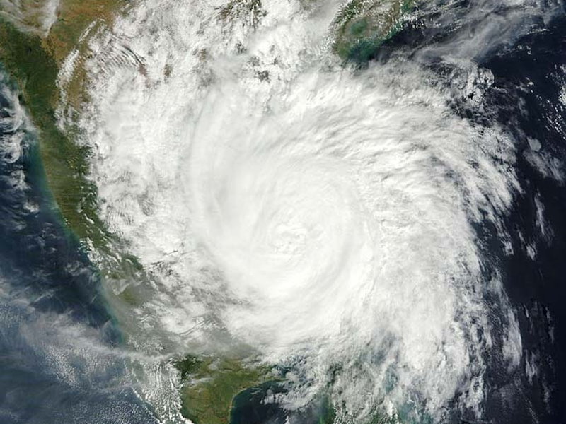
Cyclone Biparjoy at ‘blistering pace’ towards Sindh’s coastline
EVACUATIONS UNDERWAY TO SHIFT MILLIONS IN SAFE HAVENS NDMA, PMD KEEPING CLOSE EYE ON CYCLONE’S SEVERITY

- 235
- 0
KARACHI: The threat of ‘Cyclone Biparjoy’ has now reached to an alarming stage, National Disaster Management Authorities (NDMA) Chairman Lt Gen Inam Haider Malik said yesterday.
“According to scientific reports, the cyclone’s direction will turn to Keti Bandar and Indian Gujarat,” he stated, adding that an emergency had hence been imposed in all the vulnerable areas. “On June 15, it will make landfall on Keti Bandar and adjoining areas. Because of its width, far-off areas along the coastline can be affected,” Gen Malik told reporters.
He also said that in a bid to ensure the safety of those living in the country's coastal belt ahead of the very severe cyclonic system (VSCS) Biparjoy around 100,000 people will be shifted to safer places by today evening. The NDMA chairman's remarks came during a presser in the federal capital regarding the arrangement made to protect citizens ahead of June 15 the day the storm is expected to make its landfall between Karachi and India's Gujarat.
"The Sindh government along with non-governmental organisations (NGOs) and relief camp medical missions in Balochistan have been alerted," he added. The federal and provincial departments, in collaboration with the armed forces, are on high alert as Tropical Cyclone Biparjoy approaches the coastal areas of Sindh province. In the same presser, Climate Change Minister Sherry Rehman said: "The storm is now heading towards Balochistan," adding that the government is in constant touch with the NDMA.
"The storm will surely hit Keti Bandar; however, the NDMA is continuously monitoring the situation," she said. However, the climate minister assured people that the government had started taking measures to keep citizens safe. In a tweet earlier today, Rehman warned that even though the storm had downgraded from "extremely severe" to "very severe", urban flooding is likely in Karachi, given the scale and intensity of the winds. According to the Pakistan Meteorologist Department (PMD)'s latest advisory, the cyclone now lies about 470km south of Karachi, 460km south of Thatta, near Latitude 20.7°N and Longitude 67.1°E. An alert issued by the Pakistan Meteorological Department’s Tropical Cyclone Warning Centre at 9:30pm on Tuesday said said the cyclone had moved further north-northwestward during the last six hours and now lay at a distance of about 380km south of Karachi and 390km south of Thatta.
The alert said that widespread wind-dust/thunderstorm rain with some very heavy/extremely heavy falls accompanied with squally winds of 80-100km/hour gusting 120km/hour were likely in Thatta, Sujawal, Badin, Tharparkar, Mirpurkhas and Umerkot between June 13-17. Dust/thunderstorm-rain with few heavy falls and accompanied with squally winds of 60-80km/hour are likely in Karachi, Hyderabad, Tando Mohammad Khan, Tando Allahyar, Shaheed Benazirabad and Sanghar districts from June 14-16.
The PMD further said that the cyclone warning centre in Karachi was continuously monitoring the system and will issue update accordingly. According to media reports, the dust storm disrupted the traffic flow in Karachi as people were immediately heading towards their residences.
Published in The Daily National Courier, June, 14 2023
Like Business on Facebook, follow @DailyNCourier on Twitter to stay informed and join in the conversation.


